
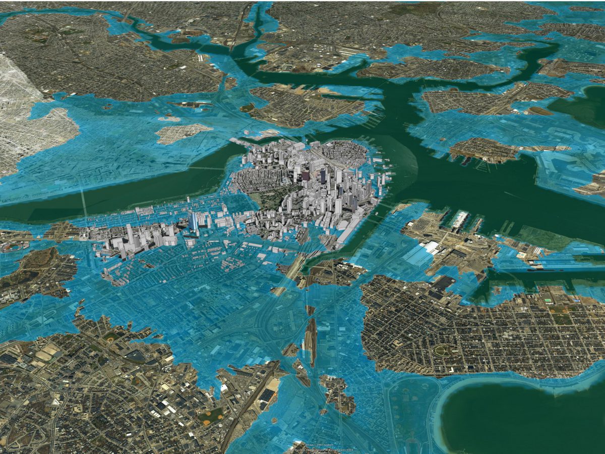
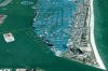
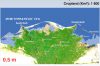
 3m Sea Level Rise, Boston
Architecture 2030
Boston, Massachusetts, United States
Credit: © 2007 2030, Inc. and © 2007 Google
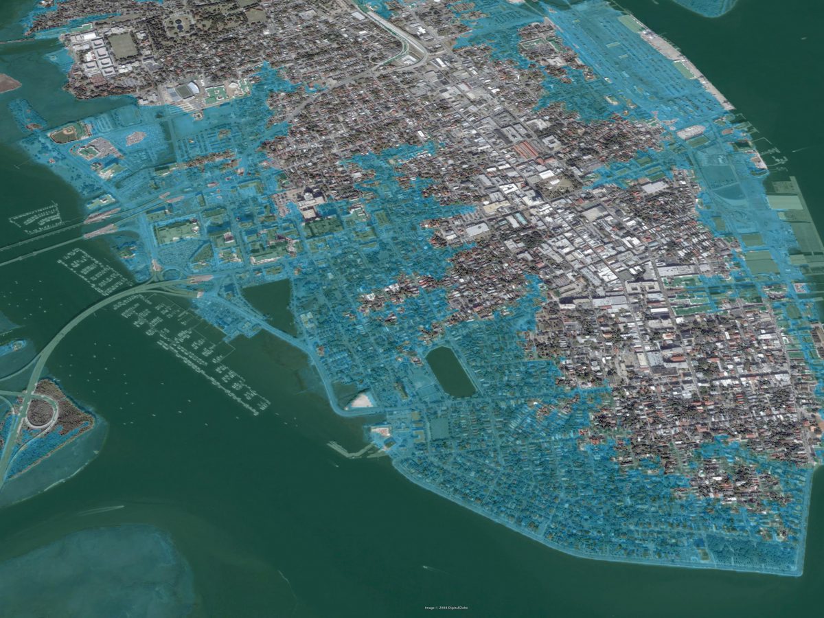
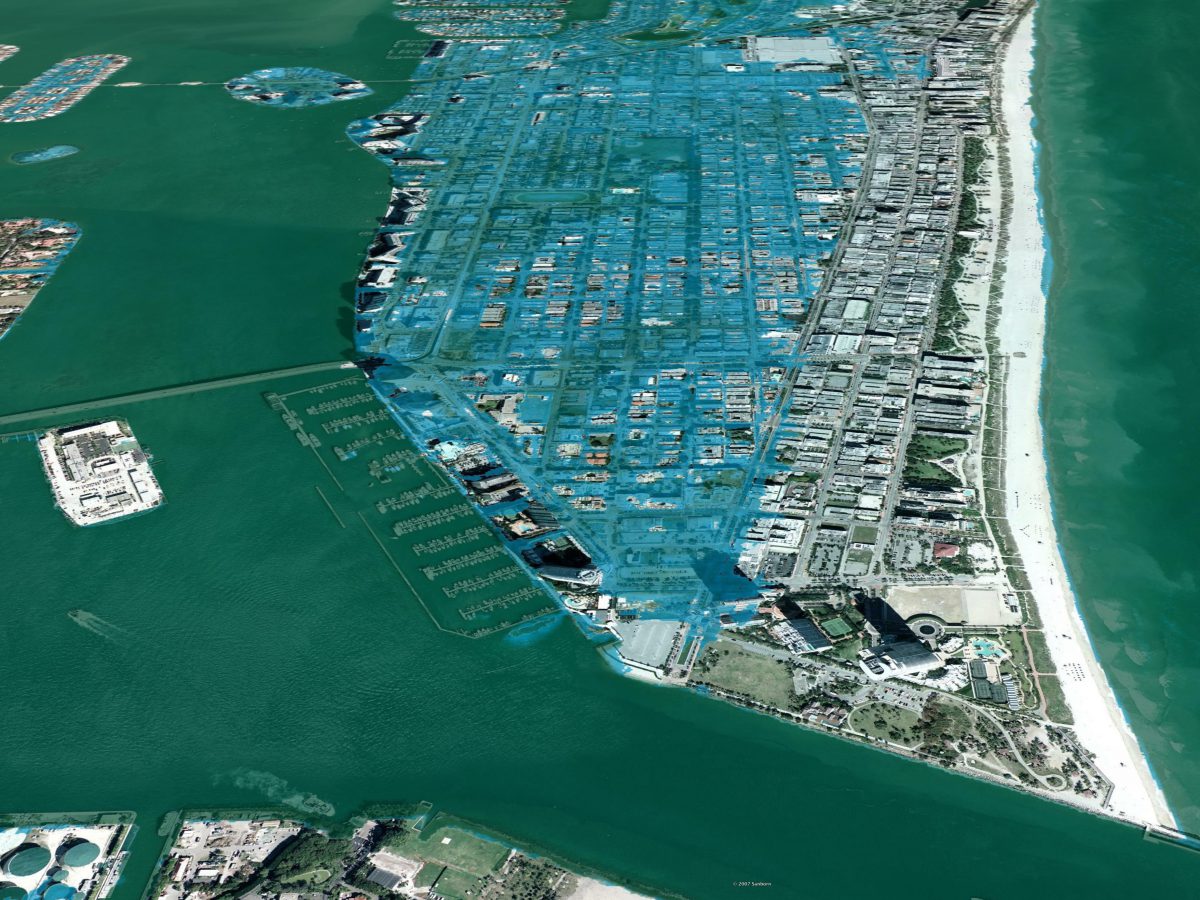


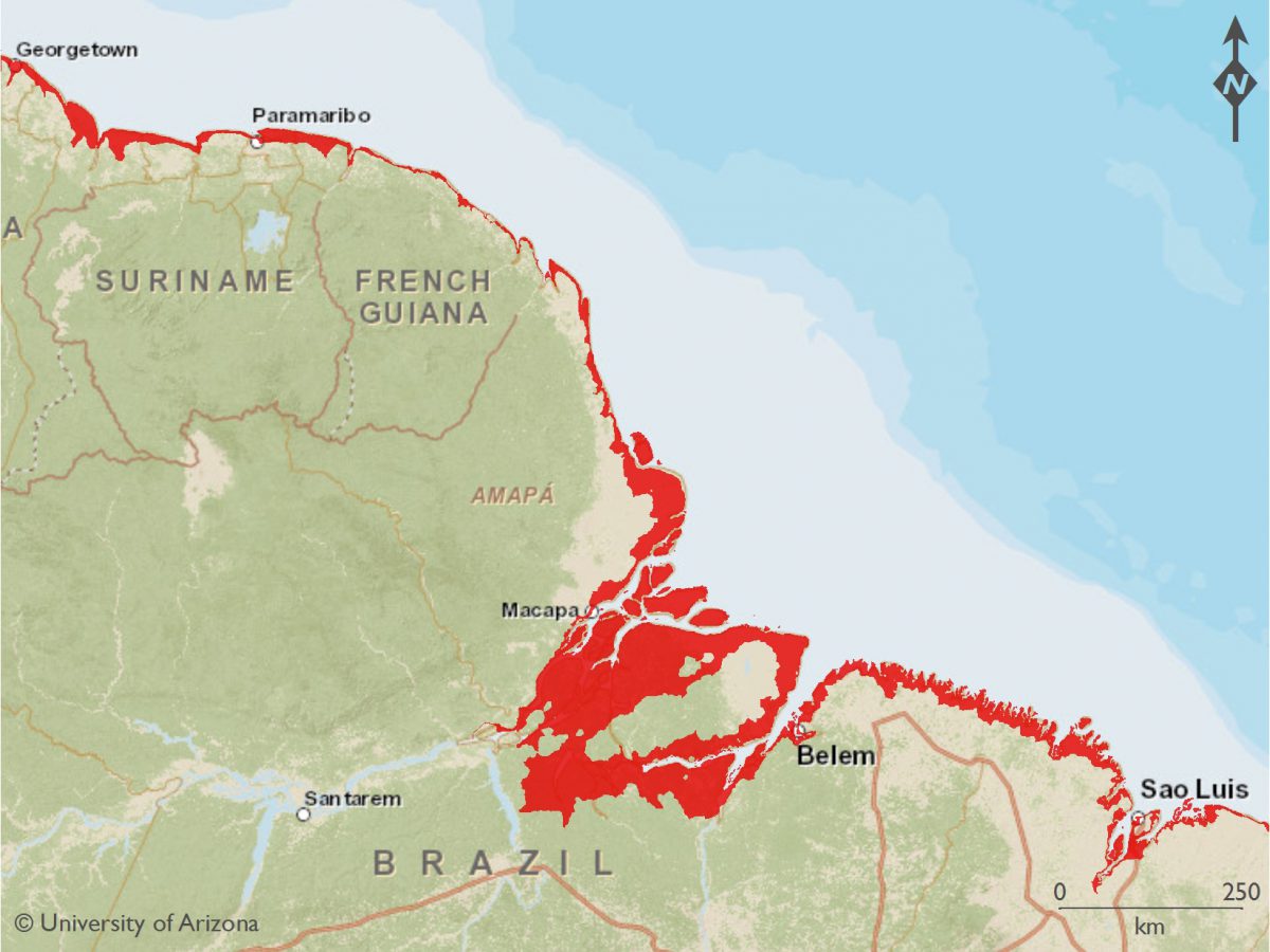
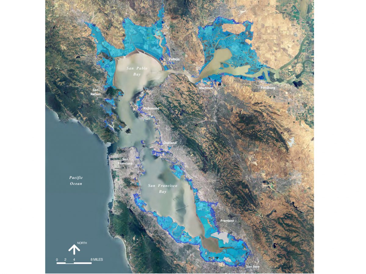

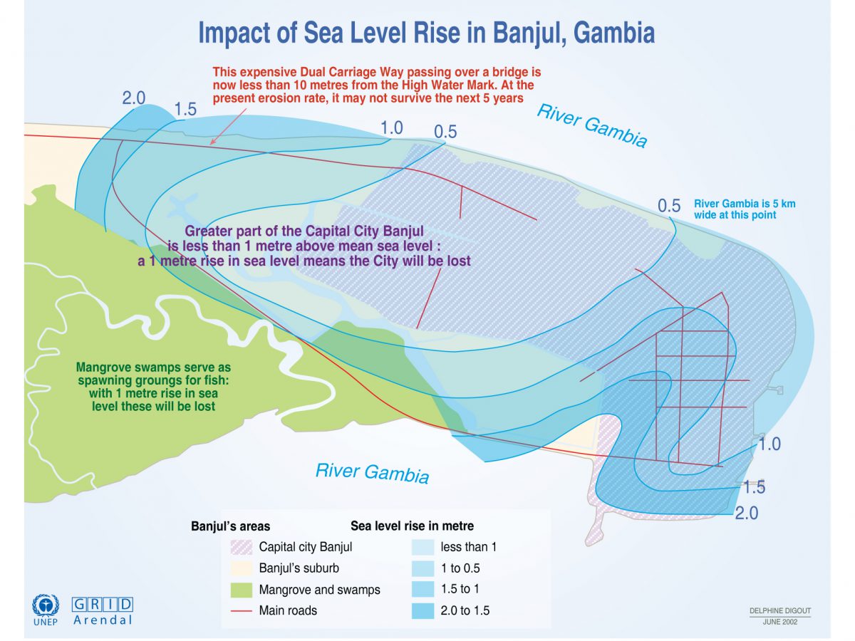


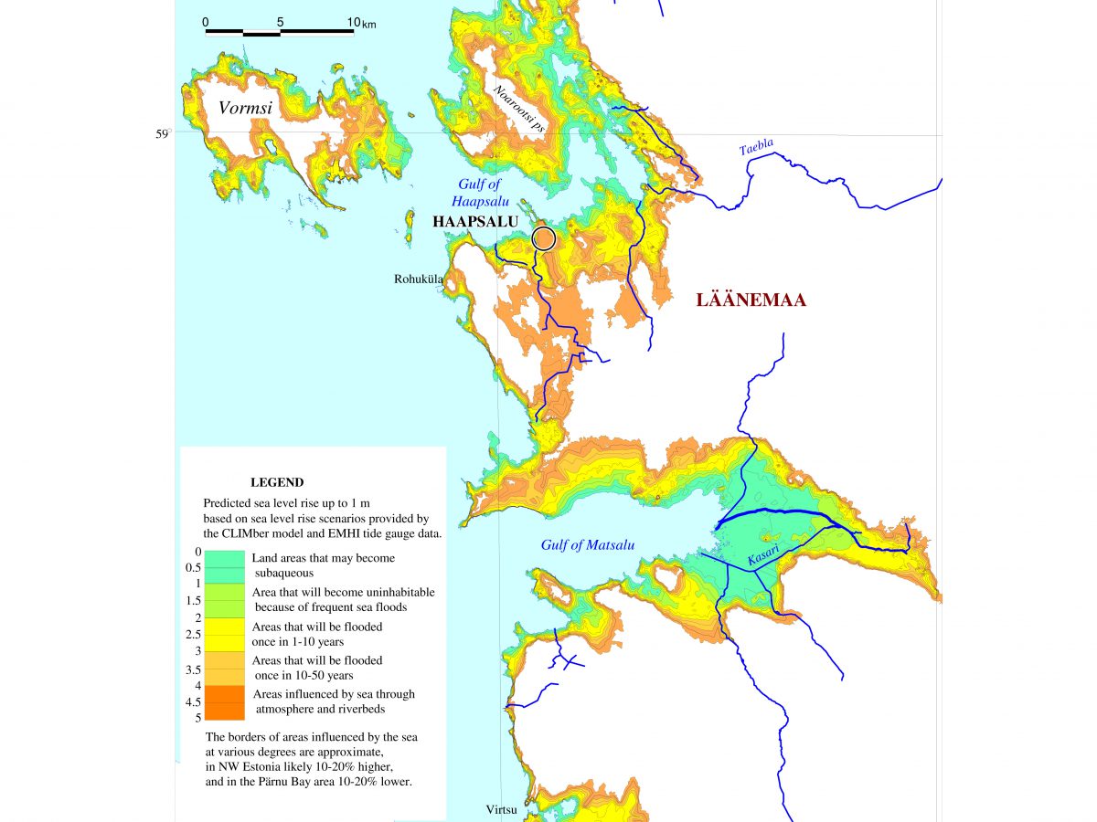


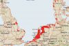


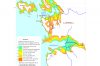
Sea level rise and storm surge maps create a detailed picture of community resources and areas exposed or vulnerable to future inundation.
Rising sea levels will inundate wetlands and low-lying lands, erode beaches, destroy infrastructure, cause population displacement, intensify flooding, and increase the salinity of rivers, bays, and groundwater tables.
Mapping a community for sea level rise and storm surge is a four-step process:
- Obtain and prepare topographical elevation data.
- Establish mean sea level and mean high water level.
- Map inundation for increments of sea level rise for 0.5 to 2 meters (1.5 to 6.5 feet) and a storm surge of 1 to 3 meters (3 to 10 feet).
- Visualize inundation and storm surge scenarios.


